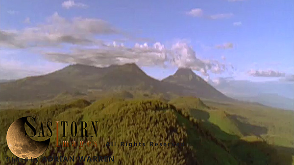
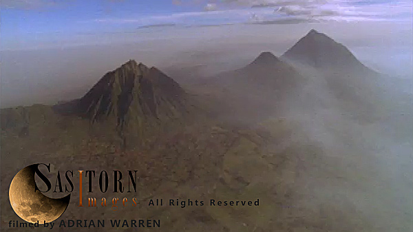
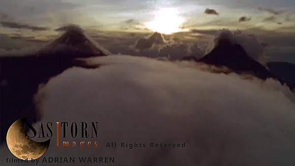
Forward tracking aerial shot, Virunga volcanoes, camera passing high over Mt Visoke (Bisoke) with Mts Sabyinyo and Gahinga in background, camera tilts down over crater lake (in shadow) camera tilts back up to show distant volcanoes surrounded by low cloud
Forward tracking aerial shot, Virunga volcanoes, camera passing high over Mt Visoke (Bisoke) with Mts Sabyinyo and Gahinga in background, camera tilts down over crater lake (in shadow) camera tilts back up to show distant volcanoes surrounded by low cloud
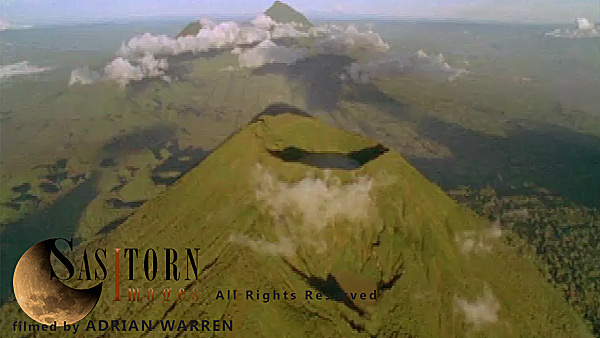
Forward tracking aerial shot, Virunga volcanoes, camera approaches Mt Visoke (Bisoke) with Mt Mikeno behind and Mt Karisimbi to left of shot, camera tilts down over crater lake and slowly tilts back up to show Mt Mikeno with cloud covered summit
Forward tracking aerial shot, Virunga volcanoes, camera approaches Mt Visoke (Bisoke) with Mt Mikeno behind and Mt Karisimbi to left of shot, camera tilts down over crater lake and slowly tilts back up to show Mt Mikeno with cloud covered summit
Forward tracking aerial shot, Virunga volcanoes, camera approaches Mt Visoke (Bisoke) with Mt Mikeno behind and Mt Karisimbi to left of shot, camera tilts down over crater lake and slowly tilts back up to show Mt Mikeno with cloud covered summit
Forward tracking aerial shot, Virunga volcanoes, camera approaches Mt Visoke (Bisoke) with Mt Mikeno behind and Mt Karisimbi to left of shot, camera tilts down over crater lake and slowly tilts back up to show Mt Mikeno with cloud covered summit
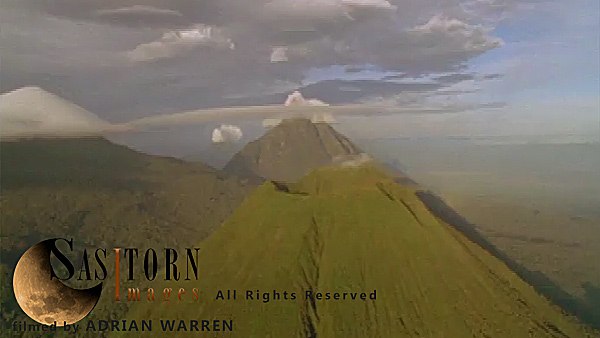
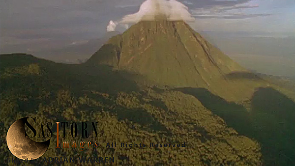
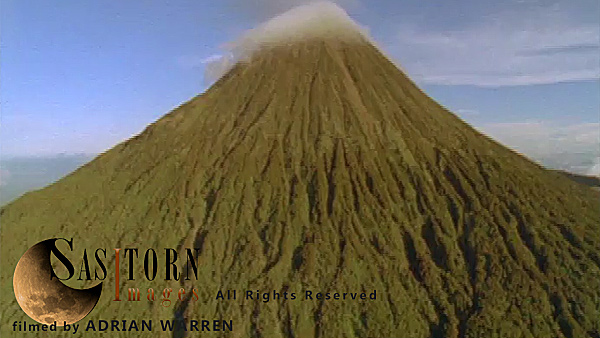
Forward tracking aerial shot of Virunga volcanoes with high and low clouds in late afternoon sun. Camera approaches Mt Visoke (Bisoke)
Forward tracking aerial shot, Virunga volcanoes, high and low clouds surrounding volcano peaks in late afternoon sun, camera approaches Mt Visoke (Bisoke)
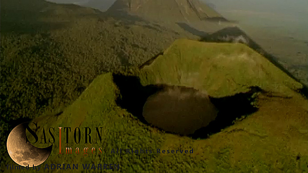
Forward tracking aerial shot, Virunga volcanoes, camera approaches Mt Visoke (Bisoke) in early morning sun with Karisimbi and Mikeno in background, camera passes high over Visoke (Bisoke), fully tilting down over crater lake and passing over to reveal open forest
Forward tracking aerial shot, Virunga volcanoes, camera approaches Mt Visoke (Bisoke) in early morning sun with Karisimbi and Mikeno in background, camera passes high over Visoke (Bisoke), fully tilting down over crater lake and passing over to reveal open forest
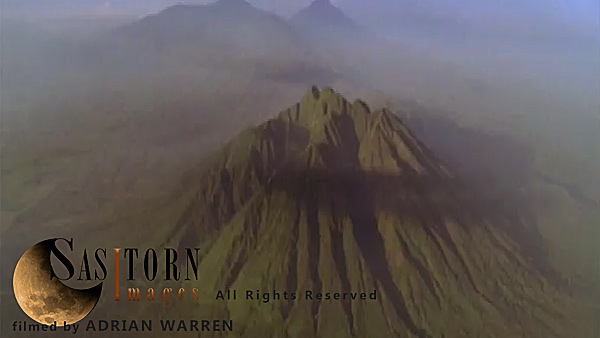
Forward tracking aerial shot, Virunga volcanoes. camera passing high over Mt Sabyinyo in morning sun, camera tilts down slowly as knife edge ridges fill shot, camera passes over summit tilting down over ridges with small wisps of cloud
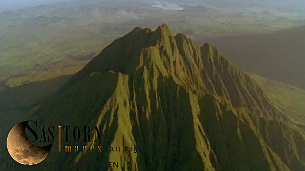
Forward tracking aerial shot, Virunga volcanoes. camera passing high over Mt Sabyinyo in morning sun, camera tilts down slowly as knife edge ridges fill shot, camera passes over summit tilting down over ridges with small wisps of cloud
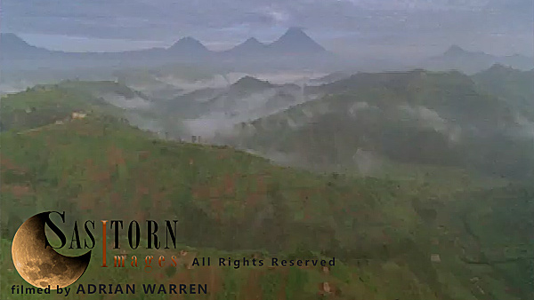
Forward tracking aerial shot, Rwandan countryside, camera passes high over misty valleys with exposed ridges, backlit by morning sunlight, through high cloud
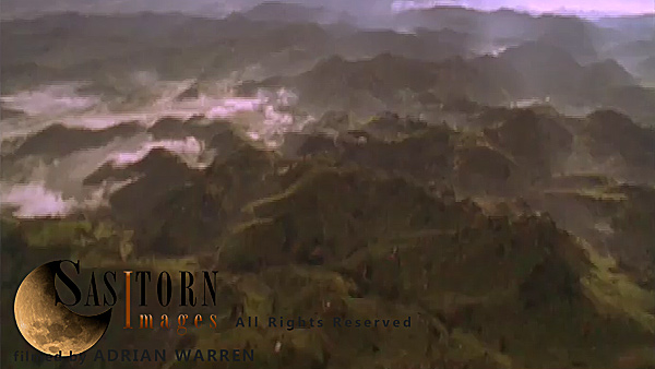
Forward tracking aerial shot, Rwandan countryside, camera passes high over misty valleys with exposed ridges, backlit by morning sunlight, through high cloud
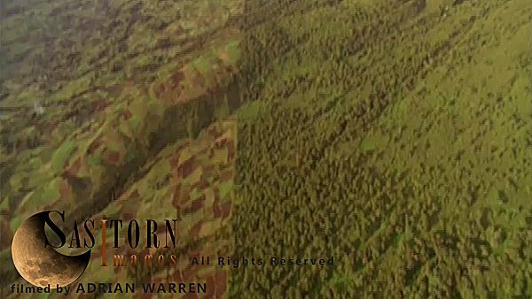
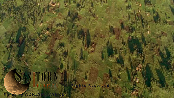
Forward tracking aerial shot, Rwandan countryside, camera tilted down vertically on evenly lit wooded farm land
Forward tracking aerial shot, Rwandan countryside, camera tilted down vertically on evenly lit wooded farm land
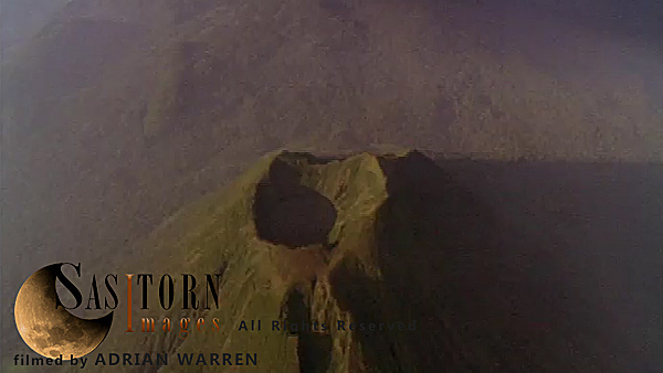
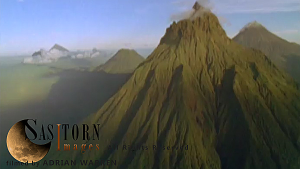
Forward tracking aerial shot, Virunga volcanoes, camera approaching smoking crater of Mt Nyiragongo surrounded by light broken of cloud in morning sun, camera tilts down over crater looking down through light broken cloud and tilts back up to horizon
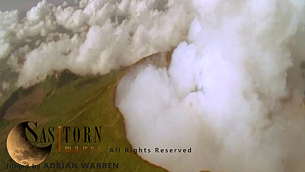
Forward tracking aerial shot, Virunga volcanoes, camera approaching smoking crater of Mt Nyiragongo surrounded by light broken of cloud in morning sun, camera tilts down over crater looking down through light broken cloud and tilts back up to horizon
Forward tracking aerial shot, Virunga volcanoes, camera approaches Mt Visoke (Bisoke) in early morning sun with Karisimbi and Mikeno in background, camera passes high over Visoke (Bisoke), fully tilting down over crater lake and passing over to reveal open forest
Forward tracking aerial shot, Virunga volcanoes, camera approaches Mt Visoke (Bisoke) in early morning sun with Karisimbi and Mikeno in background, camera passes high over Visoke (Bisoke), fully tilting down over crater lake and passing over to reveal open forest
Forward tracking aerial shot, Virunga volcanoes. camera passing high over Mt Sabyinyo in morning sun, camera tilts down slowly as knife edge ridges fill shot, camera passes over summit tilting down over ridges with small wisps of cloud
Forward tracking aerial shot, Virunga volcanoes. camera passing high over Mt Sabyinyo in morning sun, camera tilts down slowly as knife edge ridges fill shot, camera passes over summit tilting down over ridges with small wisps of cloud
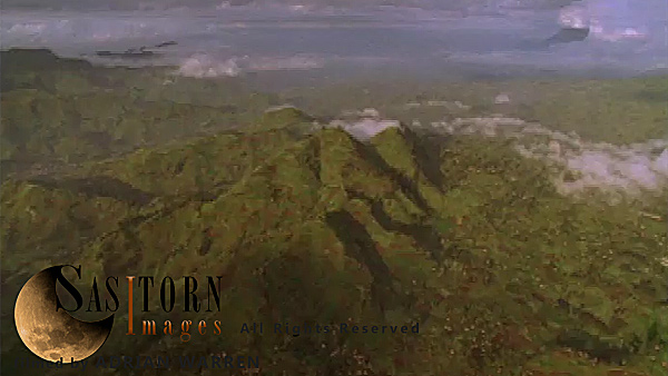
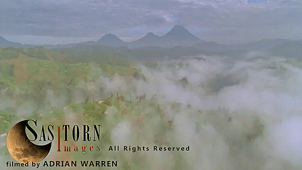
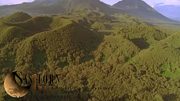
Forward tracking aerial shot, Rwandan countryside, camera passes low over cloud filled valleys with exposed wooded ridges, volcanoes in background (Mt Sabyinyo, Gahinga and Muhavura)
Forward tracking aerial shot, Rwandan countryside, camera passes low over cloud filled valleys with exposed wooded ridges, volcanoes in background (Mt Sabyinyo, Gahinga and Muhavura)
Forward tracking aerial shot, Virunga volcanoes, camera passes low over cratered forest between Sabyinyo and Visoke (Bisoke) in morning sun, Visoke (Bisoke) and cloud topped Mikeno and Karisimbi in background, camera tilts down and turns into sunlight in front of Visoke (Bisoke)
Forward tracking aerial shot, Virunga volcanoes, camera passes low over cratered forest between Sabyinyo and Visoke (Bisoke) in morning sun, Visoke (Bisoke) and cloud topped Mikeno and Karisimbi in background, camera tilts down and turns into sunlight in front of Visoke (Bisoke)
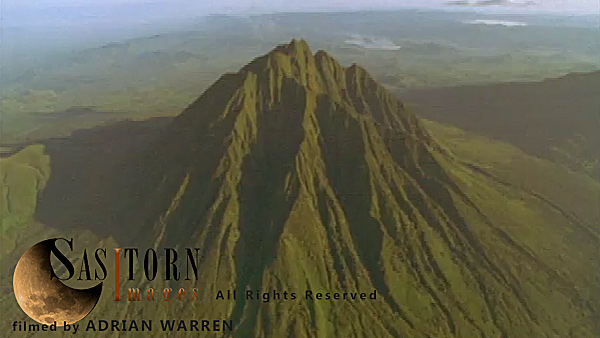
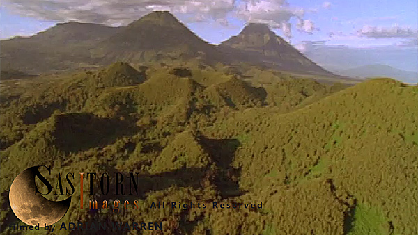
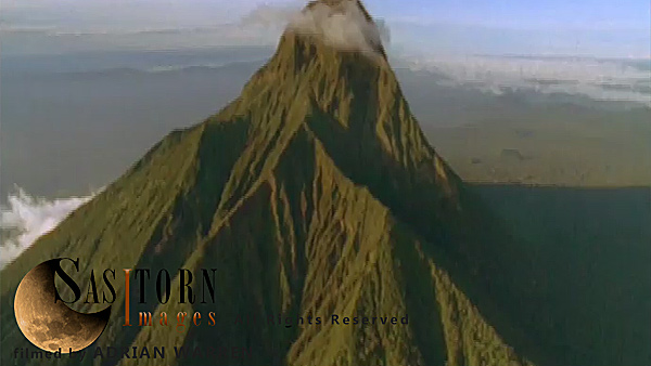
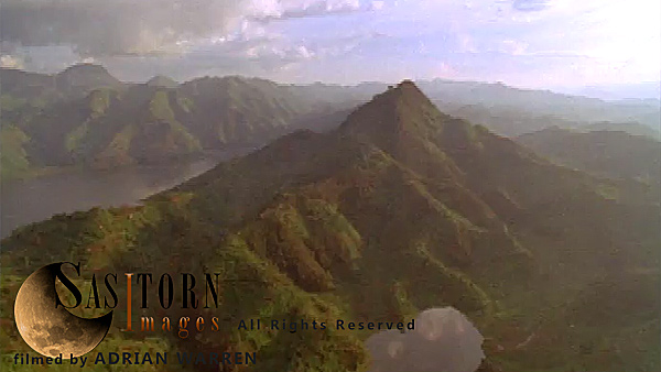
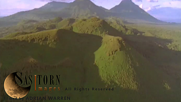
Forward tracking aerial shot, Virunga volcanoes, camera approaches Mt Sabyinyo in morning sunlight with Karisimbi, Visoke (Bisoke) and Mikeno in background, camera slowly tilts down to show detail of summit
Forward tracking aerial shot, Virunga volcanoes, camera approaches Mt Sabyinyo in morning sunlight with Karisimbi, Visoke (Bisoke) and Mikeno in background, camera slowly tilts down to show detail of summit
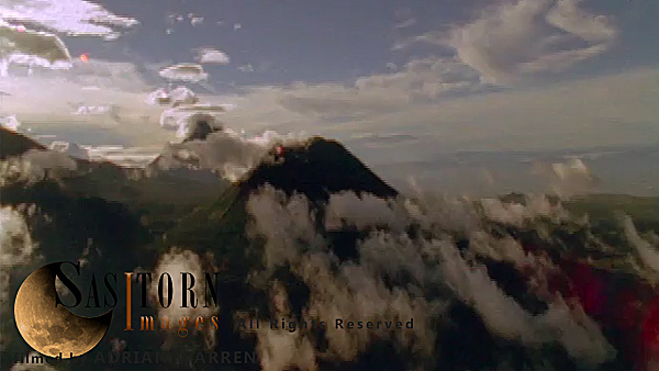
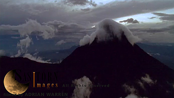
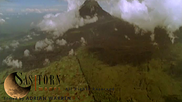
Forward tracking aerial shot, Virunga volcanoes, camera approaches Mt Sabyinyo surrounded by small broken cloud at sun set, and passes over summit through small patch of cloud revealing open forest below
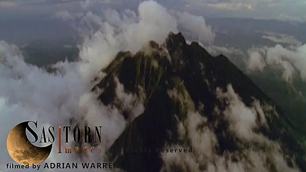
Forward tracking aerial shot, Virunga volcanoes, camera approaches Mt Sabyinyo surrounded by small broken cloud at sun set, and passes over summit through small patch of cloud revealing open forest below
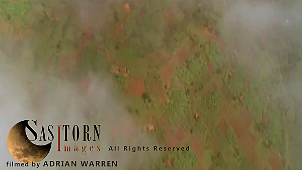
Forward tracking aerial shot, Rwandan countryside, camera passes high over hilly countryside in morning sunlight, looking towards Lake Kivu, camera tilts down over large hill to show details of fields with small patches of mist clinging to them, camera ti
Forward tracking aerial shot, Rwandan countryside, camera passes high over hilly countryside in morning sunlight, looking towards Lake Kivu, camera tilts down over large hill to show details of fields with small patches of mist clinging to them, camera ti
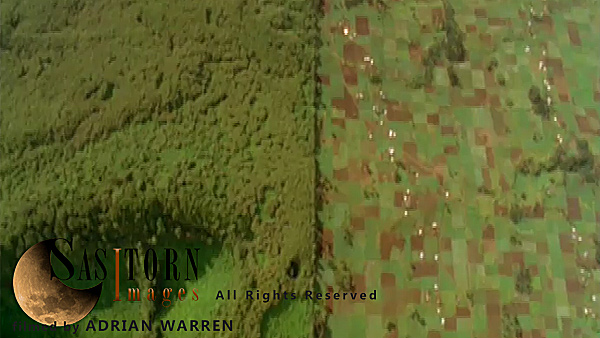
Forward tracking aerial shot, Rwandan countryside, camera tilted down oblique, passes along border of national park with patch work fields to left and forest to right
Forward tracking aerial shot, Rwandan countryside, camera tilted down oblique, passes along border of national park with patch work fields to left and forest to right
Forward tracking aerial shot, Rwandan countryside, camera passes low over farm land and mist filled valleys with exposed ridges in morning sunlight, volcanoes in background (Mt Sabyinyo, Gahinga and Muhavura)
Forward tracking aerial shot, Rwandan countryside, camera passes low over farm land and mist filled valleys with exposed ridges in morning sunlight, volcanoes in background (Mt Sabyinyo, Gahinga and Muhavura)
Forward tracking aerial shot, Rwandan countryside, camera passes low over farm land and mist filled valleys with exposed ridges in morning sunlight, volcanoes in background (Mt Sabyinyo, Gahinga and Muhavura)
Forward tracking aerial shot, Rwandan countryside, camera passes low over farm land and mist filled valleys with exposed ridges in morning sunlight, volcanoes in background (Mt Sabyinyo, Gahinga and Muhavura)
Forward tracking aerial shot, Virunga volcanoes, camera passes low over cratered forest between Sabyinyo and Visoke (Bisoke) in morning sun, Visoke (Bisoke) and cloud topped Mikeno and Karisimbi in background, camera tilts down and turns into sunlight in front of Visoke (Bisoke)
Forward tracking aerial shot, Virunga volcanoes, camera passes low over cratered forest between Sabyinyo and Visoke (Bisoke) in morning sun, Visoke (Bisoke) and cloud topped Mikeno and Karisimbi in background, camera tilts down and turns into sunlight in front of Visoke (Bisoke)
Forward tracking aerial shot, Rwandan countryside, camera tilted down, passing over field patterns and trees in late afternoon sun.
Forward tracking aerial shot, Rwandan countryside, camera tilted down, passing over field patterns and trees in late afternoon sun.
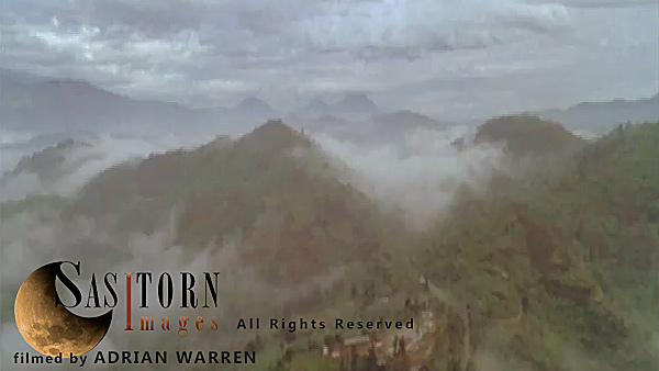
Forward tracking aerial shot, Rwandan countryside, camera tilted down looking through broken cloud in valleys showing countryside below, camera passes low over hill tops
Forward tracking aerial shot, Rwandan countryside, camera tilted down looking through broken cloud in valleys showing countryside below, camera passes low over hill tops
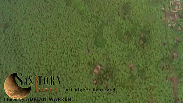
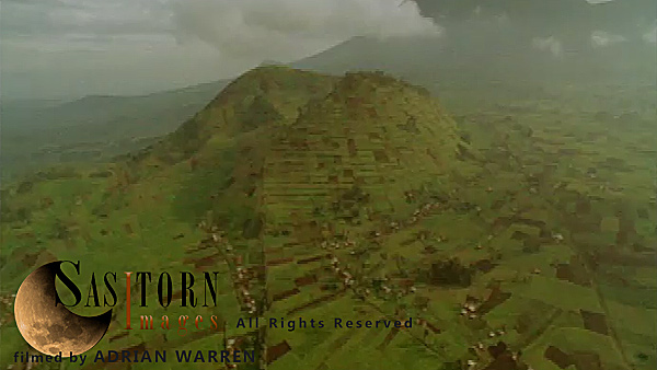
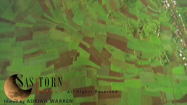
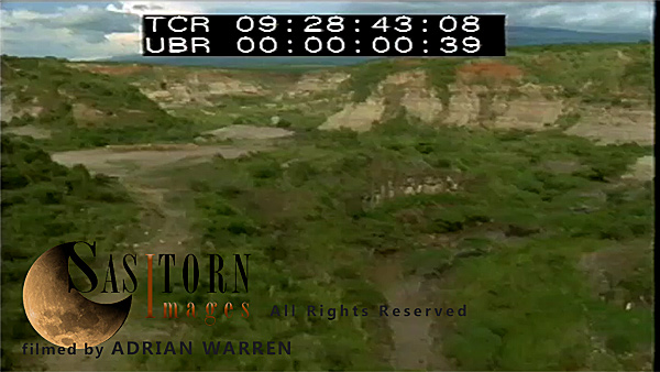
Forward tracking aerial shot, DRC countryside, camera looking down vertically on park border, forest on left, farmland on right, park finishes with shot continuing over patchwork of fields intersected by roads and buildings
Forward tracking aerial shot, DRC countryside, camera looking down vertically on park border, forest on left, farmland on right, park finishes with shot continuing over patchwork of fields intersected by roads and buildings
Forward tracking aerial shot, Virunga volcanoes, camera approaches Mt Sabyinyo in morning sunlight with Karisimbi, Visoke (Bisoke) and Mikeno in background, camera slowly tilts down to show detail of summit
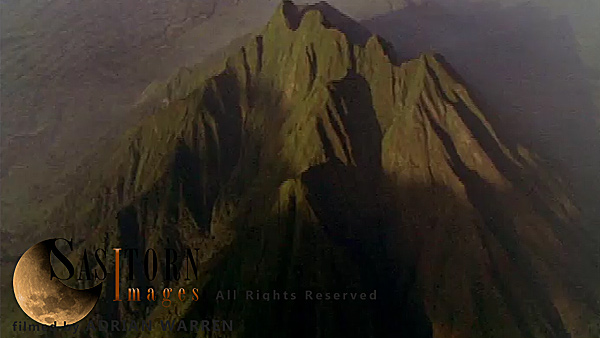
Forward tracking aerial shot, Virunga volcanoes, camera approaches Mt Sabyinyo in morning sunlight with Karisimbi, Visoke (Bisoke) and Mikeno in background, camera slowly tilts down to show detail of summit
Forward tracking aerial shot, Virunga volcanoes, camera approaches distant Mt Sabyinyo with mist shrouded peaks of Gahinga and Muhavura in distant right of shot, patchwork field visible at base of Sabyinyo
Forward tracking aerial shot, Virunga volcanoes, camera approaches distant Mt Sabyinyo with mist shrouded peaks of Gahinga and Muhavura in distant right of shot, patchwork field visible at base of Sabyinyo
Forward tracking aerial shot, Virunga volcanoes, camera approaches cloud topped peak of Mt Mikeno over low broken cloud, with thunderstorm in background. Camera passes close to the left of the peak of Mt Mikeno revealing distant, smoking silhouette of Niragongo
Forward tracking aerial shot, Virunga volcanoes, camera approaches cloud topped peak of Mt Mikeno over low broken cloud, with thunderstorm in background. Camera passes close to the left of the peak of Mt Mikeno revealing distant, smoking silhouette of Niragongo
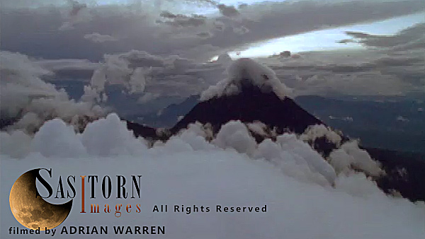
Forward tracking aerial shot, Virunga volcanoes, Mt Mikeno in late afternoon sun with light cloud at summit, camera approaches over knife edge ridges and passes to left of peak revealing open countryside
Forward tracking aerial shot, Virunga volcanoes, Mt Mikeno in late afternoon sun with light cloud at summit, camera approaches over knife edge ridges and passes to left of peak revealing open countryside
Forward tracking aerial shot, DRC countryside, approaching Mt Mikeno surrounded by low cloud with park border in foreground, strong division between farmland on left and park on right
Forward tracking aerial shot, DRC countryside, approaching Mt Mikeno surrounded by low cloud with park border in foreground, strong division between farmland on left and park on right
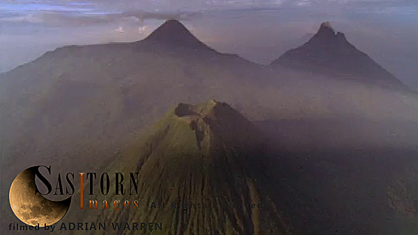
Forward tracking aerial shot, Virunga volcanoes in late afternoon sun. Camera approaches Mt Mikeno in foreground, with Mts Karisimbi and Visoke (Bisoke) behind and Mt Sabyinyo in distance
Forward tracking aerial shot, Virunga volcanoes in late afternoon sun. Camera approaches Mt Mikeno in foreground, with Mts Karisimbi and Visoke (Bisoke) behind and Mt Sabyinyo in distance
Forward tracking aerial shot, Virunga volcanoes, camera approaches Mt Visoke (Bisoke) with Mt Mikeno behind and Mt Karisimbi to left of shot, camera tilts down over crater lake and slowly tilts back up to show Mt Mikeno with cloud covered summit
Forward tracking aerial shot, Virunga volcanoes, camera approaches Mt Visoke (Bisoke) with Mt Mikeno behind and Mt Karisimbi to left of shot, camera tilts down over crater lake and slowly tilts back up to show Mt Mikeno with cloud covered summit
Forward tracking aerial shot, Rwandan countryside, camera passes low over Lake Ruhondo and surrounding hills, cloud formations reflected in the water, camera makes low pass over large ridge covered in patchwork fields
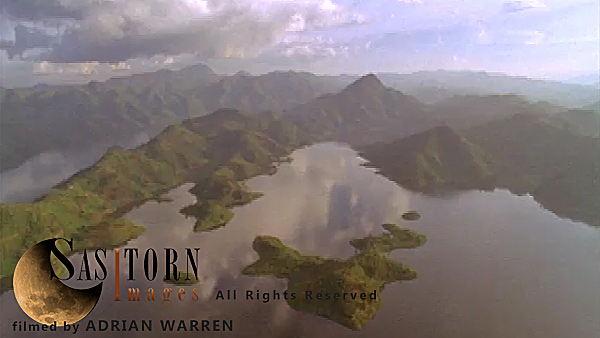
Forward tracking aerial shot, Rwandan countryside, camera passes low over Lake Ruhondo and surrounding hills, cloud formations reflected in the water, camera makes low pass over large ridge covered in patchwork fields
Forward tracking aerial shot, Rwandan countryside, camera passes low over Lake Ruhondo and surrounding hills, cloud formations reflected in the water, camera makes low pass over large ridge covered in patchwork fields
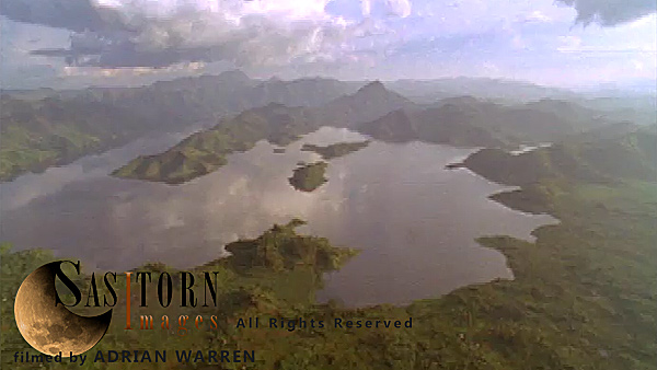
Forward tracking aerial shot, Rwandan countryside, camera passes low over Lake Ruhondo and surrounding hills, cloud formations reflected in the water, camera makes low pass over large ridge covered in patchwork fields
Forward tracking aerial shot, Virunga volcanoes, camera approaches cloud topped peaks of Mt Mikeno and Mt Karisimbi over cloud bank with setting sun in background
Forward tracking aerial shot, Virunga volcanoes, camera approaches cloud topped peaks of Mt Mikeno and Mt Karisimbi over cloud bank with setting sun in background
Forward tracking aerial shot, DRC countryside, with Virunga volcanoes in background, camera approaches two patchwork covered hills and passes over to open countryside at base of volcanoes
Forward tracking aerial shot, DRC countryside, with Virunga volcanoes in background, camera approaches two patchwork covered hills and passes over to open countryside at base of volcanoes
Forward tracking aerial shot, Virunga volcanoes, camera approaches cloud topped peak of Mt Mikeno over low broken cloud, with thunderstorm in background. Camera passes close to the left of the peak of Mt Mikeno revealing distant, smoking silhouette of Niragongo
Forward tracking aerial shot, Virunga volcanoes, camera approaches cloud topped peak of Mt Mikeno over low broken cloud, with thunderstorm in background. Camera passes close to the left of the peak of Mt Mikeno revealing distant, smoking silhouette of Niragongo
Forward tracking aerial shot, Virunga volcanoes, camera approaching Mt Mikeno with lenticular cloud on peak
Forward tracking aerial shot, Virunga volcanoes, camera approaching Mt Mikeno with lenticular cloud on peak
Forward tracking aerial shot, Virunga volcanoes, camera passes low over cratered forest between Sabyinyo and Visoke (Bisoke) in morning sun, Visoke (Bisoke) and cloud topped Mikeno and Karisimbi in background, camera turns into sunlight in front of Visoke (Bisoke)
Forward tracking aerial shot, Virunga volcanoes, camera passes low over cratered forest between Sabyinyo and Visoke (Bisoke) in morning sun, Visoke (Bisoke) and cloud topped Mikeno and Karisimbi in background, camera turns into sunlight in front of Visoke (Bisoke)
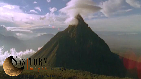
Forward tracking aerial shot, Virunga volcanoes, camera approaching Mt Karisimbi in late afternoon sun with lenticular cloud on peak.
Forward tracking aerial shot, Virunga volcanoes, camera approaching Mt Karisimbi in late afternoon sun with lenticular cloud on peak.
Forward tracking aerial shot, DRC countryside. Camera tilted down following road running through patchwork fields on hills
Forward tracking aerial shot, DRC countryside. Camera tilted down following road running through patchwork fields on hills
Forward tracking aerial shot, Rwandan countryside, camera passes low over Lake Ruhondo and surrounding hills, cloud formations reflected in the water, camera makes low pass over large ridge covered in patchwork fields
Forward tracking aerial shot, Rwandan countryside, camera passes low over Lake Ruhondo and surrounding hills, cloud formations reflected in the water, camera makes low pass over large ridge covered in patchwork fields
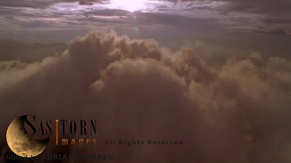
Forward tracking aerial shot, camera passes over backlit clouds towards weak sunset through higher cloud
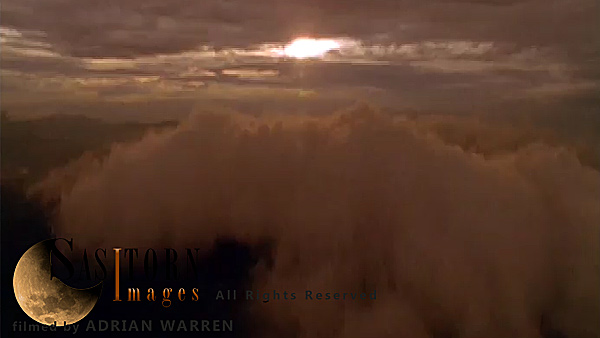
Forward tracking aerial shot, camera passes over backlit clouds towards weak sunset through higher cloud
Forward tracking aerial shot, Virunga volcanoes, camera approaching smoking crater of Mt Nyiragongo surrounded by light broken of cloud in morning sun, camera tilts down over crater looking down through light broken cloud and tilts back up to horizon
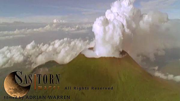
Forward tracking aerial shot, Virunga volcanoes, camera approaching smoking crater of Mt Nyiragongo surrounded by light broken of cloud in morning sun, camera tilts down over crater looking down through light broken cloud and tilts back up to horizon
Forward tracking aerial shot, Virunga volcanoes, camera passes over old lava flow / cinder plains towards crater of Nyamuragira (Nyamulagira), camera passes over crater with steaming vents to reveal smoking, silhouetted Nyiragongo
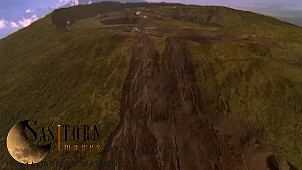
Forward tracking aerial shot, Virunga volcanoes, camera passes over old lava flow / cinder plains towards crater of Nyamuragira (Nyamulagira), camera passes over crater with steaming vents to reveal smoking, silhouetted Nyiragongo
Forward tracking aerial shot, Virunga volcanoes, camera passes low over cratered forest between Sabyinyo and Visoke (Bisoke) in morning sun, Visoke (Bisoke) and cloud topped Mikeno and Karisimbi in background, camera turns into sunlight in front of Visoke (Bisoke)
Forward tracking aerial shot, Virunga volcanoes, camera passes low over cratered forest between Sabyinyo and Visoke (Bisoke) in morning sun, Visoke (Bisoke) and cloud topped Mikeno and Karisimbi in background, camera turns into sunlight in front of Visoke (Bisoke)
Forward tracking aerial shot, camera passes over backlit clouds towards weak sunset through higher cloud
Forward tracking aerial shot, camera passes over backlit clouds towards weak sunset through higher cloud
AWNG5108 (173, 12:06:13:09)
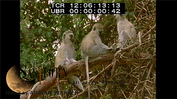
MS: 3-SHOT: Vervet Monkeys sitting on branch of spiky tree
AWNG5021 (170, 11:10:49:14)
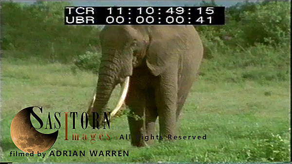
MS: bull Elephant feeding on grass
AWNG5111 (173, 12:06:35:11)
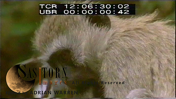
CU: Vervet Monkeys grooming
AWNG5025-2 (170, 11:12:48:01)
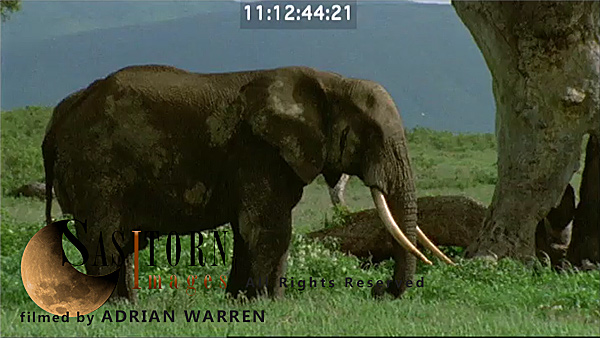
CU: bull Elephant feeding
AWNG5025 (170, 11:12:48:01)
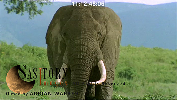
CU: bull Elephant feeding
AWNG5023 (170, 11:11:40:22)
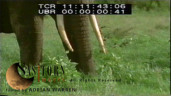
CU: two bull Elephants feeding
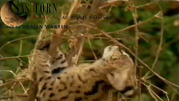
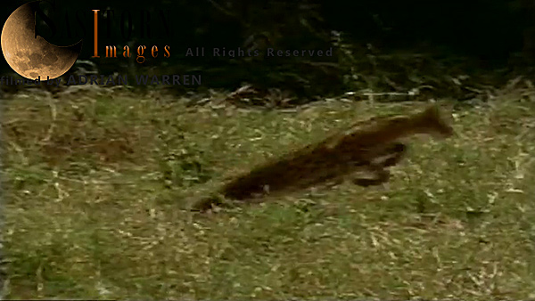
Serval sample
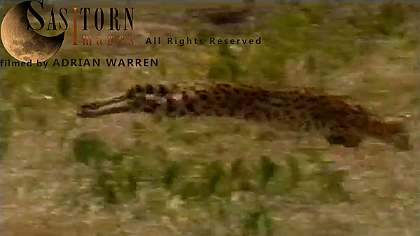
Serval female (mother) hunting
Serval sample
MS: Serval kittens playing in grass
AWNG5034 (170, 11:15:21:22)
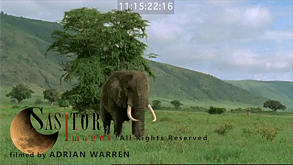
MS to CU: bull Elephant walking towards camera, out of frame to R, Crater rim in background
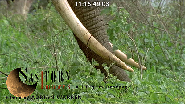
AWNG5027 (170, 11:13:31:04)
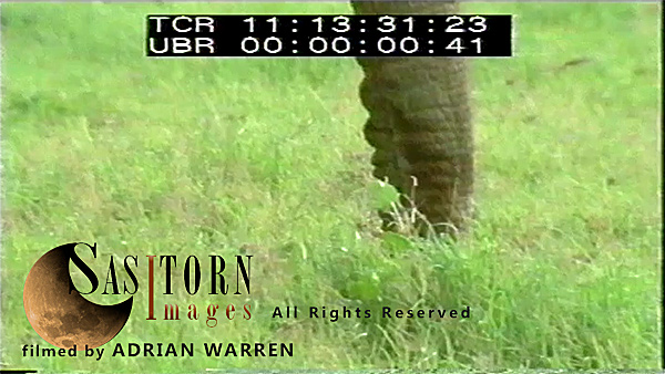
CU: bull Elephant’s trunk, feeding
Serval sample
Serval female (mother) hunting
AWNG5078 (172, 11:34:31:03)
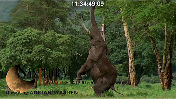
MS zooms to CU: bull Elephants stands on its hind legs reaching up for leaves of Yellow fever Acacia, tries twice and walks away from camera
AWNG5034a (170, 11:15:49:01)
BCU: bull Elephant’s trunk, feeding, camera moves to face
AWNG5079 (172, 11:35:15:13)
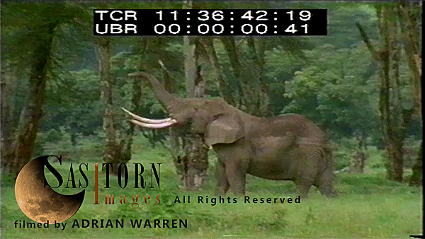
MS: bull Elephant walking away from camera, stops and feeds on grass
AWNG5019-3 (169, 11:02:18:11)
Aerial: Hand held: Crater with Rainbow: from forest over Crater rim into the Crater, passing over Ngoitokitok Spring and lake Magadi (check section for embargo)
AWNG5019 (169, 11:02:18:11)
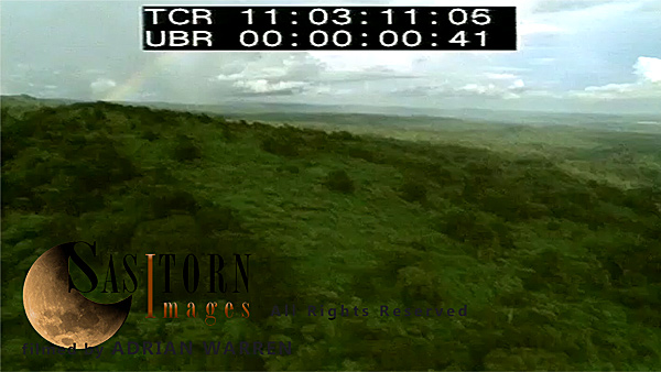
Aerial: Hand held: Crater with Rainbow: from forest over Crater rim into the Crater, passing over Ngoitokitok Spring and lake Magadi (check section for embargo)
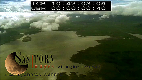
AWNG5014 (168, 10:41:45:20)
Aerial: Hand held: Ngorongoro Crater, with clouds over the lake Magadi
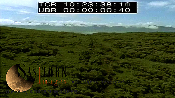
AWNG4999 (166, 10:17:19:02)

Forward facing Aerials: Gol Mountains: low pass over Gol Mountains gorge
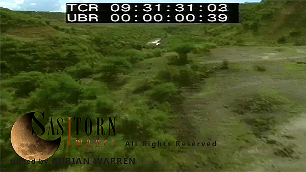
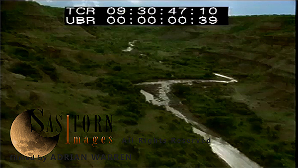
AWNG4977-2 (163, 09:30:45:08)
Forward facing Aerials: very low pass over Stream in Olduvai Gorge
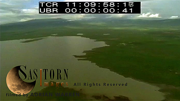
AWNG5001 (167, 10:21:27:14)
Forward facing Aerials: from outside of the rim, onto the rim and reveals the Crater with Lake Magadi and Crater rim with clouds on top in background
AWNG4977 (163, 09:30:45:08)
Forward facing Aerials: very low pass over Stream in Olduvai Gorge
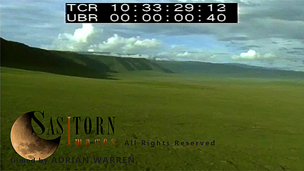
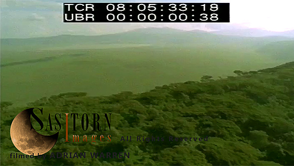
AWNG5007 (168, 10:33:27:11)
Forward facing Aerials: Crater and its rim, looking from Crater towards the rim
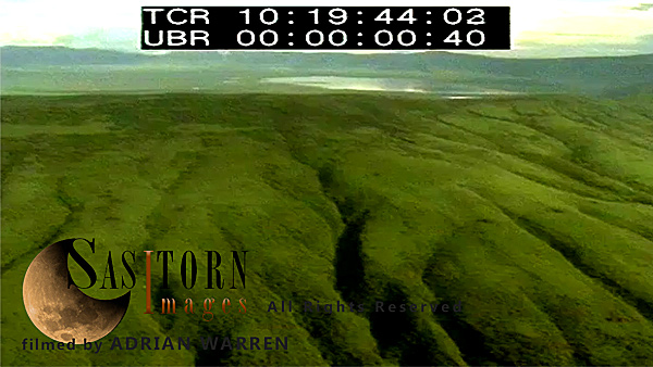
AWNG5000 (166, 10:19:40:05)
Forward facing Aerials: from outside of the rim, onto the rim and reveals the Crater with Lake Magadi and Crater rim
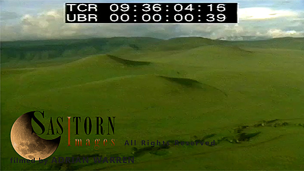
AWNG4980 (164, 09:36:01:09)
Forward facing Aerials: over Munge Stream, and hills beyond
AWNG4976-2 (163, 09:26:58:09)
Forward facing Aerials: low pass over Olduvai Gorge
AWNG5019-2 (169, 11:02:18:11)
Aerial: Hand held: Crater with Rainbow: from forest over Crater rim into the Crater, passing over Ngoitokitok Spring and lake Magadi (check section for embargo)
AWNG5008 (168, 10:34:26:04)
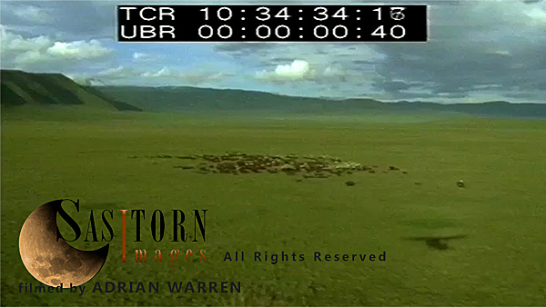
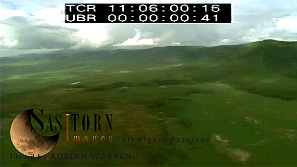
Forward facing Aerials: Ngorongoro Crater, pass over a herd of Cape Buffaloes
AWNG4996 (166, 10:10:43:13)
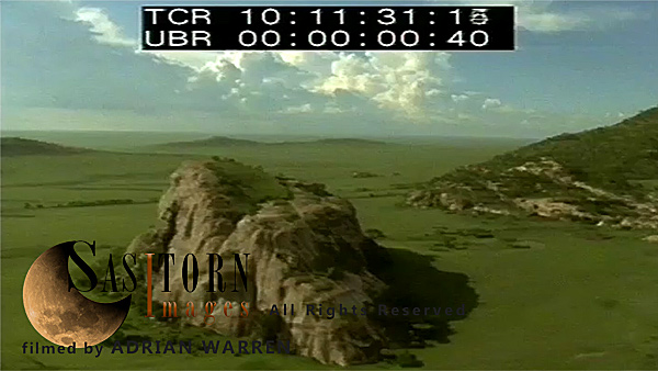
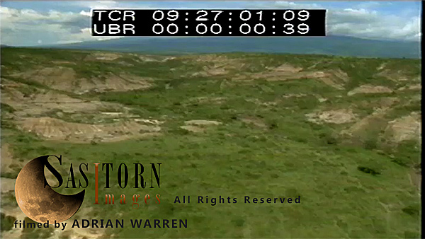
Forward facing Aerials: Serengeti Plain with rocky outcrops, Gol Mountains in background
AWNG4994 (165, 10:08:57:20)
Forward facing Aerials: from Forest on Crater rim, shot reveals the Crater with Magadi Lake and Crater rim in background (*check for embargo section)
AWNG5015 (168, 10:42:30:15)
Aerial: Hand held: Ngorongoro Crater, with clouds over the lake Magadi
AWNG5004 (167, 10:26:53:06)
Forward facing Aerials: Ngorongoro Crater with clouds, with Lake Magadi and Crater rim in background
AWNG4998 (166, 10:14:49:20)
Forward facing Aerials: Serengeti : over hills, dry water bed on Serengeti Plain, with Gol Mountains in background
AWNG4993 (165, 10:07:23:24)
Forward facing Aerials: from Forest on inside slope of Crater rim into the Crater
AWNG4990 (165, 10:00:05:24)
Forward facing Aerials: slowly low pass over Lerai forest, with Magadi Lake and Crater rim in background: check section for embargo
AWNG4979 (164, 09:33:37:11)
Forward facing Aerials: from Crater towards the rim, pass over Lerai forest, tilted down shot to the forest
AWNG4931 (159, 08:30:14:10)
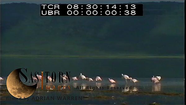
MWA: Flamingo flock walking slowly to left, in water, Crater rim in background
AWNG4890 (158, 08:11:17:18)
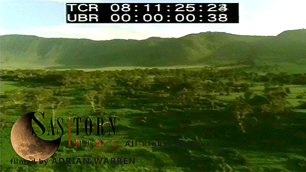
Aerial: Hand held out of right hand door: Lerai Forest under beautiful afternoon light
AWNG4820 (155, 06:34:44:09)
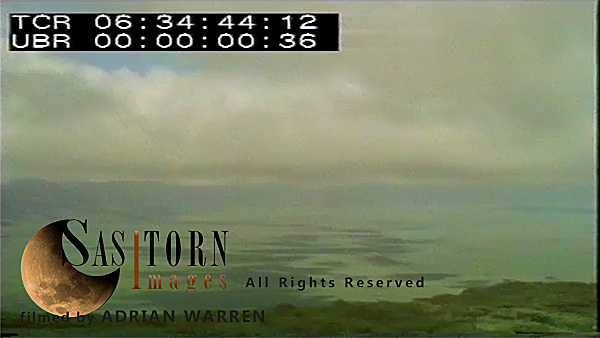
Time lapse: Clouds shadows on Crater floor (area North of Ngoitokitok)
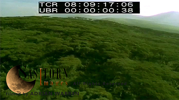
AWNG4975 (163, 09:24:48:04)
Forward facing Aerials: Olduvai Gorge and the plain beyond
AWNG4969 (162, 09:11:33:05)
Forward facing Aerials: over Lerai Forest, approaching the Crater rim and turns towards the crater again
AWNG4930 (159, 08:30:00:21)
MWA: Flamingos, walking and preening in water
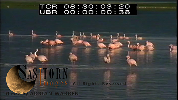
AWNG4921 (159, 08:25:49:03)
MS: Flamingos, frightened and fly off to right (flight in slow motion)
AWNG4821 (155, 06:35:21:01)
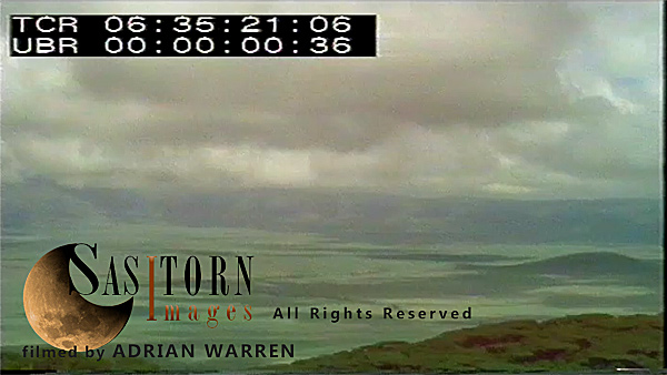
Time lapse: Clouds shadows on Crater floor (Munge area)
AWNG4818 (155, 06:33:59:01)
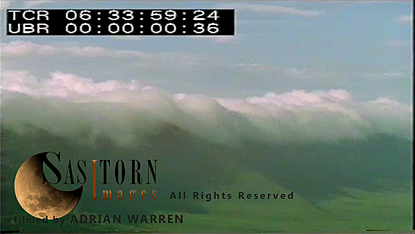
Time Lapse: MWA Clouds on Crater rim and flowing over into Crater
AWNG4884 (157, 08:02:47:04)
Aerial: Hand held out of right hand door: Crater and its Rim, looking from Rim towards Crater, Lake Magadi in left hand background
AWNG4817 (155, 06:33:17:09)
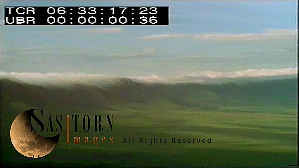
Time Lapse: WA Clouds on Crater rim and flowing over into Crater
AWNG4974 (163, 09:23:01:08)
Forward facing Aerials: Serengeti Plain: Animals on the plain
AWNG4915 (159, 08:23:28:03)
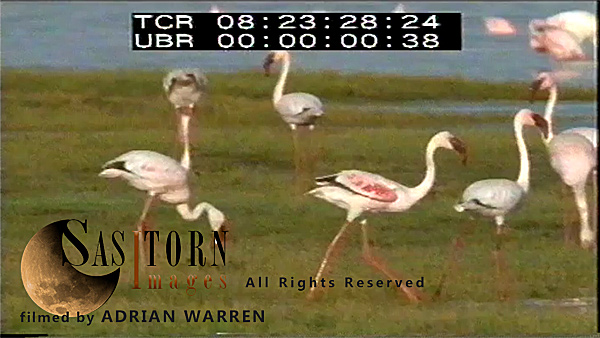
MS: Lesser Flamingos on grass, frightened and half run half fly and settle down in water (check section for embargo)
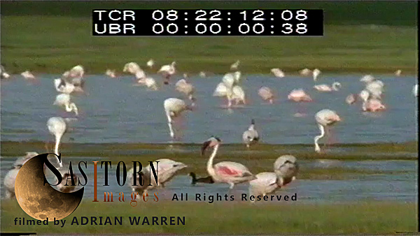
AWNG4913 (159, 08:22:04:14)
MS: Flamingos feeding, panning to L, suddenly ones nearer to shore in foreground frightened and fly off to R
AWNG4976 (163, 09:26:58:09)
Forward facing Aerials: low pass over Olduvai Gorge
AWNG4920 (159, 08:25:12:14)
CU: Flamingos frightened, half run half fly to settle away from shore
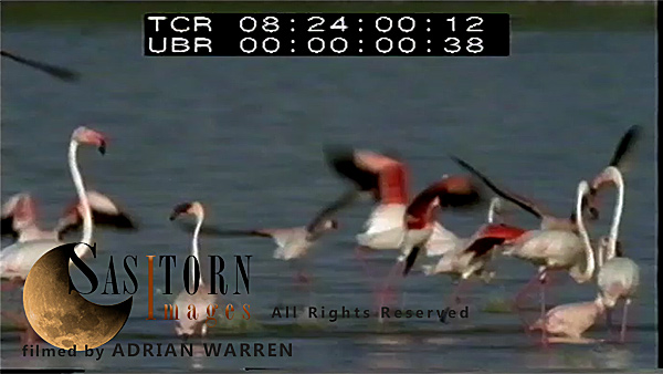
AWNG4918 (159, 08:24:32:04)
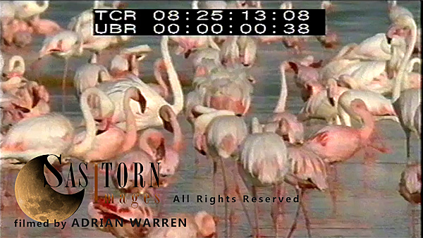
MS: Flamingos flock in water, ones in foreground walking slowly to left
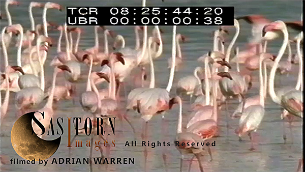
AWNG4917 (159, 08:24:06:08)
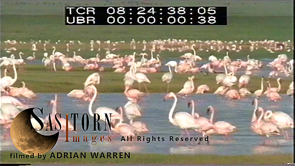
MS: Flamingos flying and coming to land among many others feeding (check section for embargo)
AWNG4888 (157, 08:09:58:11)
Aerial: Hand held out of right hand door: Crater and its Rim, looking from Rim towards Crater, Lake Magadi in left hand background
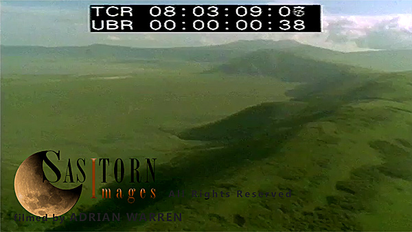
AWNG4885 (157, 08:03:51:08)
Aerial: Hand held out of right hand door: Crater and its Rim, looking from Rim towards Crater, Lake Magadi in left hand background